

From discovery to mass production, a copper belt traditionally takes over a decade; however, with the "New Rapid Exploration Technology System" officially released on May 30, this timeline has been rewritten—the underground treasure can transform from "data" to "ore" in as little as two years. On May 30, 2026, the new rapid exploration technology system, jointly developed by the Chinese Academy of Sciences, Huanya Earth Science, and Zijin Geophysical Exploration, was officially launched in Beijing. Employing a full-process operational model of "AI-empowered hyperspectral satellite prospecting + sky-earth integrated precision detection + intelligent drilling verification," it compresses the overall mineral resource development cycle from the traditional over a decade to 2 to 3 years, marking China's geological exploration's comprehensive transition from "human eye monitoring of mountains" into a new era of "data-driven and intelligent prospecting."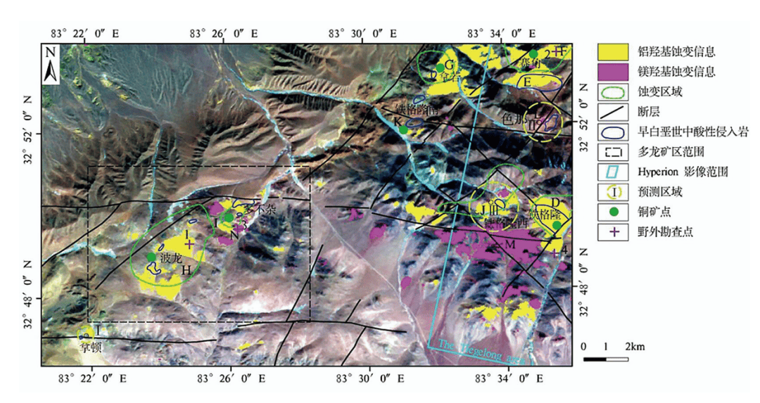
"The Prospecting Dilemma": Technical Bottlenecks Behind the Decade-Long Cycle
The mining industry is a strategic foundational sector of the national economy. Strategic minerals such as copper, iron, gold, lead-zinc, lithium, and cobalt are not only the "food" for industrial production but also the lifeline of strategic emerging industries like high-end manufacturing and new energy. However, traditional geological exploration has long relied on manual experience, hand-drawn mapping, and sporadic geophysical and geochemical surveys, suffering from three major pain points:
Prolonged Cycle: From large-scale regional reconnaissance → anomaly delineation → target verification → systematic exploration → reserve assessment, a complete mineral exploration process often takes over a decade, severely restricting resources from moving "underground" to "market." Low Efficiency: In areas with weak geological survey coverage, such as high altitudes, deserts, and gobi terrains, personnel access is difficult, and traditional methods are nearly ineffective. High Costs: Large-scale drilling layouts involve significant blindness, with substantial investment wasted on "barren boreholes."
The "15th Five-Year Plan" explicitly identifies "industry-academia-research integrated innovation" as a strategic pathway for technological breakthroughs. Against this backdrop, the Chinese Academy of Sciences, Huanya Earth Science, and Zijin Geophysical Exploration, after years of collaborative research, have deeply integrated new-generation information technologies such as hyperspectral satellite remote sensing, artificial intelligence, and big data with traditional geological exploration methods, launching the "New Rapid Exploration Technology System" that disrupts traditional prospecting models.
The "Three Gates" of Sky-Earth Integrated Intelligent Exploration
The core achievement of this technology system lies in constructing a full-process intelligent closed-loop operational model of "rapid point identification within areas—rapid discovery at points—rapid drilling at points."
First Gate: Point Identification within Areas—"Sky Eye Scanning," Completing Years of Screening in Two Weeks
The first step of traditional prospecting—regional reconnaissance—requires geologists to traverse mountains and conduct field mapping, with preliminary work on a large metallogenic belt often taking years. In contrast, this technology system utilizes AI-empowered hyperspectral satellite prospecting technology (HYMI-X), integrating hyperspectral satellite remote sensing data with intelligent algorithms to perform "spectral fingerprint" identification of surface minerals. It completes regional screening that previously took years in just two weeks, rapidly delineating high-potential prospecting targets.
The core logic of hyperspectral remote sensing lies in the fact that different minerals possess unique spectral features in the electromagnetic spectrum, akin to human "fingerprints"—iron oxide minerals exhibit strong absorption features in specific bands, clay minerals have distinct reflection peaks in the near-infrared band, and carbonate minerals show characteristic absorption valleys in the mid-infrared band. AI algorithms automatically interpret vast amounts of spectral data, upgrading prospecting from "experience-driven" to "data-driven."
Second Gate: Discovery at Points—"Perspective Diagnosis," Precisely Locating Underground Ore Bodies
After locking in preliminary targets, the technology system enters the second step—"discovery at points." This phase introduces drone surveys and high-power geophysical equipment for detailed "perspective" detection of targets, using geophysical methods such as 3D resistivity imaging and induced polarization to precisely delineate the spatial morphology and burial boundaries of underground ore bodies. It confirms "whether there is ore underground and how large it is" within just a few weeks, significantly reducing sunk costs from blind drilling.
Third Gate: Drilling Verification—"Acupoint Verification," Zero Waste Holes for Precise Hits
At the most favorable locations identified in the first two steps, drilling projects are rapidly deployed to verify mineralization information. Once the ore body's presence is confirmed, systematic detailed exploration is immediately initiated to quickly ascertain the ore body's scale and grade. The three steps form a closed loop: satellite "scanning" → drone/geophysical "penetration" → drilling "verification," progressively converging and focusing, transforming traditional "probability-based" prospecting into "precision-based" intelligent prospecting.
Demonstration Application Over 4 Million Square Kilometers, with a Match Rate of Up to 90%
This technology system is by no means a "laboratory concept." To date, the technology has been applied in demonstrations covering over 4 million square kilometers globally. For various strategic mineral resources such as copper, iron, gold, lead-zinc, lithium, and cobalt, the ore body verification match rate reaches up to 90%. This means that for every 10 predicted ore bodies, 9 are confirmed through actual drilling, bringing the prospecting "hit rate" close to the theoretical limit of geological exploration.
Domestically, the technology's advantages are particularly pronounced in areas with weak geological survey coverage and difficult personnel access, such as Inner Mongolia, Xinjiang, Qinghai, and Tibet—regions characterized by high altitudes, deserts, and gobi terrains. In the heart of plateaus over 4,000 meters above sea level, the operational window for traditional geologists to traverse and map is only a few months; however, HYMI-X technology completes full-area scanning via satellite remote sensing in just two weeks. Coupled with remote-controlled drones and intelligent geophysical equipment, it breaks the physical limitations imposed by natural conditions on human prospecting activities, providing robust support for comprehensively understanding the domestic mineral resource "baseline."
Reshaping the International Competitiveness of China's Mining Industry
The advent of the new rapid exploration technology system holds profound strategic significance on three levels: industry, resource security, and technological autonomy.
Industry Level: Compressing the development cycle from over a decade to 2 to 3 years means that enterprises can more accurately grasp global mineral price cycles, shifting from "passive waiting" to "active capture" to seize market opportunities. Lin Xiaobing, Secretary-General of the Eurasian System Science Research Association, pointed out that this system is a concrete manifestation of new quality productive forces in the field of prospecting, driving geological exploration towards a new stage of digitalization, intelligence, and standardization.
Resource Security Level: Strategic minerals such as lithium, cobalt, and rare earths are the "industrial food" for the new energy industry and high-end manufacturing. Rapidly understanding the domestic resource "baseline" through intelligent exploration technology and strengthening the development and reserves of strategic minerals has direct strategic value in alleviating the risk of resource "bottlenecks" and enhancing national energy and resource security.
Technological Autonomy Level: From the HYMI-X hyperspectral satellite algorithm to high-power geophysical equipment, this technology system achieves full-chain self-sufficiency and control, marking China's entry into the world-class level in the field of exploration technology. Multiple academicians and geological experts highly praised the system at the briefing, believing that its release has gathered broad consensus and marks a new phase for China's rapid mineral resource exploration, transitioning from technological exploration to large-scale application.
The New Era of AI Prospecting
Mineral resource exploration is a high-risk, long-cycle, and capital-intensive strategic undertaking, with its success rate and investment cycle long constraining the development of the global mining industry. The advent of the new rapid exploration technology system provides a clear answer: through the deep integration of AI, hyperspectral remote sensing, big data, and traditional geology, mineral exploration is expected to move from "relying on nature" to "scientific prediction."
As the Eurasian System Science Research Association stated: "This technological innovation holds profound strategic significance for enhancing the international competitiveness of China's mining industry and overcoming key technical challenges in the field of mineral exploration." When vast amounts of geological data are awakened by intelligent algorithms, and when satellites, drones, geophysical surveys, and drilling are woven into a fully covered intelligent exploration network, China's geological exploration is undergoing a paradigm shift—from "prospecting by luck" to "prospecting by algorithms," China is rewriting the exploration rules of the global mining industry.