
From arduous on-site manual surveying and measurement acceptance reliant on human experience, to autonomous drone takeoff and AI-powered automatic modeling and calculation—Guoneng Beidian Shengli Energy Co., Ltd. (hereinafter referred to as "Shengli Energy") is undergoing a profound "unmanned" transformation of its open-pit coal mine. At its core is the nationally pioneering, mine-specific, integrated software and hardware equipment hailed as the "Open-pit Mine Safety Guardian"—the "Intelligent Survey and Safety Patrol" integrated platform.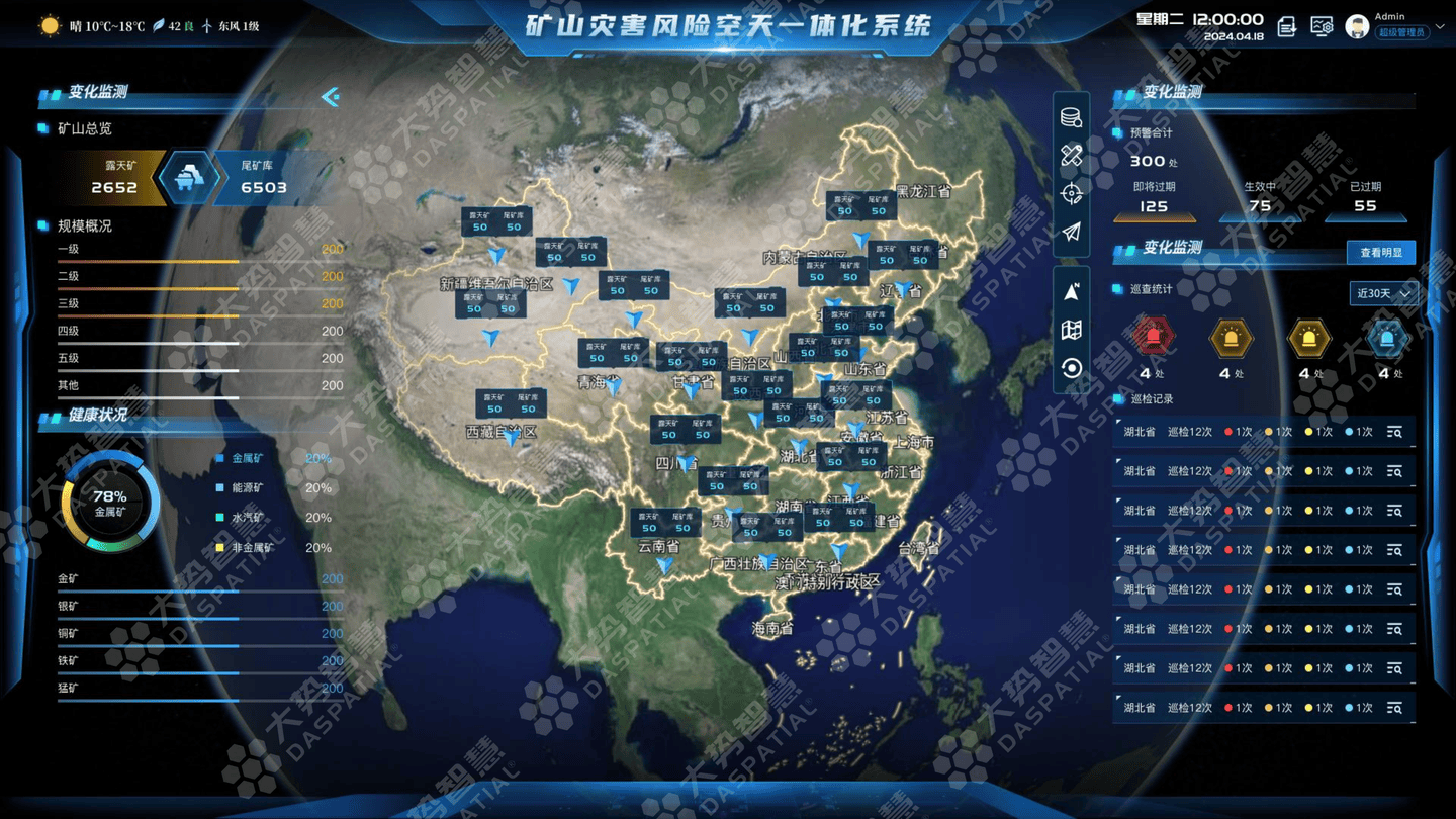
Addressing common industry challenges such as the vast scope of open-pit coal mining areas, long measurement acceptance cycles, heavy reliance on manual labor for data transmission, and frequent accidents, Shengli Energy has made smart mine construction a key focus. Breaking through the geographical limitations and data silos between traditional equipment, the company successfully independently developed and deployed this nationally first full-process unmanned intelligent system.
Compared to underground coal mines, open-pit mines feature vast pits and steep slopes. Traditional manual surveyors still needed to descend to the pit bottom even on windy days, with safety incidents accounting for over 25% of total open-pit mine accidents. To solve this pain point, the "Intelligent Survey and Safety Patrol" platform innovatively constructs an "Air-Ground-Cloud" collaborative, domain-wide perception network. Utilizing an integrated management and control platform, it fuses data from drones, vehicle-mounted systems, and fixed monitoring points, achieving a magnificent shift from traditional experience-driven methods to multi-dimensional big data collaborative driving. Its core technological innovations involve multi-source data collaborative perception, real-time interconnection, autonomous analysis, and ultimate early warning capabilities, achieving a major breakthrough in preventing mine production safety hazards at the source.
Unmanned Air, Ground, and Cloud Trinity for the Entire Process
Highlight One: Autonomous Drone Surveying – Moving Surveyors from the Pit Bottom to the Command Center
The "Intelligent Survey and Safety Patrol" platform uses drones equipped with LiDAR to achieve centimeter-level scanning, conducting high-precision aerial surveys and 3D modeling of the mining area, effectively "moving" the mine onto computer screens. The platform possesses capabilities including unmanned autonomous surveying, automatic real-scene 3D modeling, AI intelligent analysis, and spatiotemporal big data. On this basis, a system comprising an Unmanned Surveying Operations Center, a Spatial Data Center, an AI Intelligent Computing Center, and a Comprehensive Application Center has been built, enabling full-cycle, high-precision intelligent perception of the open-pit coal mine scenario. Based on dynamic modeling technology using LiDAR point cloud data, the update speed for bench models within a range of several hundred meters of the ore body can now be increased to once every 20 minutes, representing an efficiency increase of over 500%, significantly surpassing traditional manual surveying.
Highlight Two: AI Intelligent Analysis – Automatic "Accounting" with Centimeter-Level Precision
The platform utilizes massive drone orthophotos and 3D point cloud data to establish a fully automatic calculation system for excavation volume, transportation distance, and climbing height. It also pioneeringly introduces multiple intelligent analysis algorithms, including AI verification of road construction quality, landslide and crack identification, dynamic monitoring of ecological restoration, and subsidence identification. Traditional measurement acceptance often required dozens of engineers to go on-site for manual measurement, which was not only inefficient but also posed significant personal safety risks; now, with a single click, the total coal inventory and excavation volume for the entire mine can be accurately calculated in just a few minutes, with error precision controlled at the centimeter level.
Highlight Three: Multi-Source Collaborative Perception – Full Domain Coverage via Air-Space-Ground Integration
The platform is not supported by a single device but is a multi-dimensional linkage system constructed from drones, ground-based vehicle-mounted inspection systems, slope radar, and geological sensors. Through a unified spatiotemporal data foundation, each system achieves a full-chain closed-loop supervision of "Aerial Cruise Suspected Warning – Ground Robot Targeted Investigation – System Platform AI Intelligent Judgment." This technical system is considered by industry experts to be the first to achieve truly full-process, minimally manned, intelligent surveying and safety supervision in the complex environment of large, high-altitude, cold open-pit mining areas in the north. The platform has been included in the 2026 key science and technology projects of the CHN Energy Group and is an industry first in terms of equipment system connectivity, 3D digital twin reconstruction, and AI algorithm practice.
Enhancing Mine Digitalization and Safety Supervision Capabilities
The deployment and use of the "Intelligent Survey and Safety Patrol" integrated platform has ultimately achieved a fundamental shift in open-pit coal mine safety supervision from "passive defense and experience-based judgment" to "active early warning and intelligent decision-making."
In terms of economic benefits, this technology directly shortens the surveying and mapping cycle by over 80%, significantly freeing up personnel efficiency. It liberates the hands of staff long engaged in high-intensity field work, allowing them to transition to roles in data analysis and intelligent decision-making, greatly reducing the labor intensity of frontline operators. Overall mining area operational efficiency has consequently increased by at least 30%.
In terms of safety production, by predicting hazards such as slope slippage and geological subsidence in advance, AI intelligent analysis replaces the high-risk links of manual on-site inspection. This not only reduces the incidence of safety accidents but also builds a solid defense line for the safety management and control of smart mines. After establishing a unified spatiotemporal data foundation, the platform enables the fusion and interoperability of multi-source data, completely breaking down the "data barriers" that previously existed between various professional departments within the mine.
Currently, Shengli Energy is building a super-large smart mine demonstration zone based on this platform. Its technical system of "observing from the sky, inspecting on the ground, and managing online" holds significant promotional value for high-altitude, cold mining areas in China. In the future, this technology is expected to further integrate deeply with large model training and edge computing, enabling inspection robots to progress from "seeing" surface anomalies to "understanding" safety precursors, achieving three-dimensional, all-weather, full-cycle unmanned inspection.