
On September 2, based on its launched series of high-resolution remote sensing satellites, Chang Guang Satellite Technology Co., Ltd. (hereinafter referred to as "CGST") established the world's largest stereo mapping satellite constellation and released a high-precision 3D stereo product matrix, providing routine data support for the construction of "Real 3D China."

Schematic diagram of the "Jilin-1" stereo mapping satellite constellation.
Currently, the commercial aerospace industry has entered a fast track of large-scale development, with a continuous increase in the number of in-orbit satellites and ever-expanding and deepening application scenarios. As an important application direction of satellite remote sensing, 3D stereo mapping is playing an increasingly critical foundational role in fields such as natural resource surveys, urban planning and construction, disaster assessment and management, and infrastructure monitoring.
To enhance stereo mapping service capabilities, CGST has successively overcome key technologies including spaceborne fusion intelligent imaging, multi-satellite formation collaborative stereo observation, and automated production of multi-view stereo models. It has successfully launched 19 new-generation high-resolution optical remote sensing satellites equipped with high-precision stereo mapping capabilities, establishing the world's largest stereo mapping satellite constellation to date.
This constellation supports multiple stereo imaging acquisition modes, including single-satellite same-orbit stereo, dual-satellite formation stereo, and multi-satellite multi-view stereo. The longest single-strip imaging of a dual-satellite formation can reach 1,600 kilometers, with a single stereo imaging area exceeding 20,000 square kilometers. Leveraging large-scale constellation collaborative scheduling, CGST has achieved a transformation from "single stereo acquisition" to "constellation multi-view collaboration," from "local mapping" to "large-area stereo coverage," and from "periodic updates" to "high-frequency dynamic reconstruction," propelling satellite stereo mapping into a new stage of rapid dynamic updates and fine 3D reconstruction.
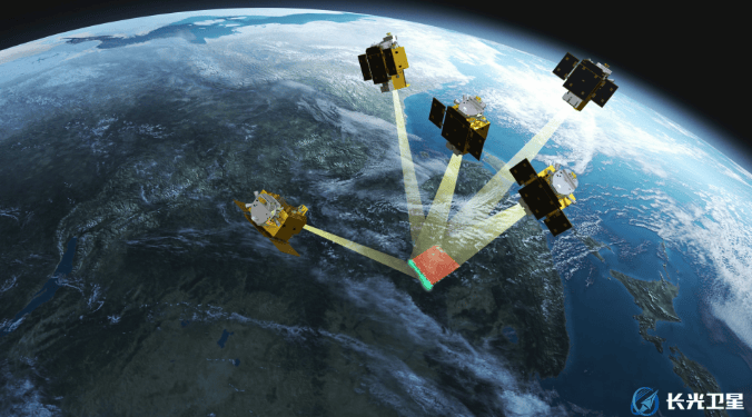
Schematic diagram of the "Jilin-1" five-satellite formation.
Based on the constellation's powerful stereo data acquisition capabilities, CGST has also developed a 3D stereo product matrix, whose accuracy indicators have reached internationally advanced levels. In addition to utilizing single-satellite maneuverability to provide dual-view and triple-view stereo pair data, it can also rely on multi-satellite collaboration within the constellation to acquire five-view stereo pair data. Through multi-angle observation, it effectively compensates for occlusions and blind spots in building facades, complex roof structures, and steep terrain, significantly enhancing the texture completeness, geometric reliability, and detail expression of 3D model surfaces. Furthermore, it can efficiently produce high-precision digital surface models (DSM), high-precision digital elevation models (DEM), 3D white models, and realistic 3D models.
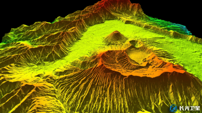
"Jilin-1" high-precision digital surface model (DSM) product view — Mount Bromo, Indonesia.
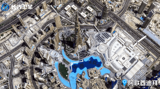
"Jilin-1" high-precision 3D stereo product view — Dubai, UAE.
The high-precision 3D stereo product matrix can be widely applied in fields such as natural resource survey and management, surveying and mapping planning and engineering investigation, water conservancy and environmental protection, energy infrastructure monitoring, emergency disaster assessment, and digital city construction. In special scenarios such as drone no-fly zones or restricted data acquisition, it can also serve as a reliable alternative data source, providing dependable support for related operations.