
Academician Li Deren, recipient of the State Preeminent Science and Technology Award, introduced the Dongfang Huiyan satellite constellation plan on September 9 at the 2026 Geographic Information Technology Innovation Conference: by 2030, 258 satellites will be deployed, covering multiple payload types including optical, radar, hyperspectral, and thermal infrared.
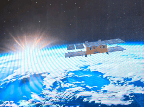
The constellation's first operational satellite, Dongfang Huiyan Gaofen-01, was launched on February 3, 2024; on August 5, 2026, Dongfang Huiyan Hyperspectral-01 and -02 were launched into orbit. At present, the three satellites are operating as a network, further validating a new model integrating hyperspectral remote sensing with AI.
Li Deren said that compared with Europe's Sentinel-2, the Dongfang Huiyan hyperspectral satellites have similar orbits and compatible spectra, but higher resolution and more spectral bands. Comparative validation shows that their quality has reached the internationally leading level.
It is understood that the Dongfang Huiyan constellation is an intelligent remote sensing satellite system led by Academician Li Deren's team. It will consist of 150 high-resolution optical satellites, 100 radar satellites, 4 hyperspectral satellites, and 4 thermal infrared satellites, aiming to build an integrated space-air information real-time intelligent service system for "communication, navigation, remote sensing, and computing."
Building the Dongfang Huiyan constellation is intended to provide data support for the development of spatiotemporal intelligence.
At the conference, Li Deren gave a presentation on "how to make spatiotemporal intelligence drive artificial intelligence into the physical world": "Artificial intelligence is a smart brain, while spatiotemporal intelligence focuses on understanding the dynamic changes of the physical world. Spatiotemporal intelligence is the only way to push artificial intelligence from virtual space and cyberspace into physical space and the real world."
He divided the development of artificial intelligence into four stages—language intelligence, "reading ten thousand books"; image intelligence, "viewing ten thousand images"; spatial intelligence, "traveling ten thousand miles"—ultimately leading to the intelligent world created by spatiotemporal intelligence.
China has already achieved multiple results in using spatiotemporal intelligence to boost new quality productive forces: Li Deren's team used more than 20,000 images from the Ziyuan-3 satellite to complete nationwide 1:50,000 mapping without ground control points, achieving accuracy of 3 to 4 meters. On this basis, in cooperation with China Aerospace Science and Technology Corporation, it completed a global 1:50,000 map covering 130 million square kilometers, supporting national defense and relevant United Nations applications; using Sentinel-1 satellite data, deformation measurement accuracy reached 4.8 millimeters per year, validated based on more than 2,000 CORS stations (continuously operating reference stations), and applied to deformation monitoring of landslides, debris flows, urban land subsidence, reservoir dams, and more; based on massive 0.5-meter-resolution imagery, AI automatically identified more than 18 million greenhouses nationwide, providing data support for precise disaster compensation... "Our next step is to create a global 1:2,000 true 3D digital model without control points," Li Deren said.
United Nations forecast data indicates that by 2030 the global geographic information industry output value will reach approximately 1.44 trillion U.S. dollars. Li Deren called for: "We should bring 30% of this industry to China."
The 2026 Geographic Information Technology Innovation Conference, with the theme "The Way of Geography: GIS as the Foundation, AI as the Enabler," aims to promote the upgrade of geographic information systems to intelligent spatiotemporal systems and create a "spatiotemporal smart brain" oriented toward the real world. At the conference, the "GeoScene Product Xinchuang Adaptation White Paper" and a fully domestic geographic information technology software-hardware integrated Xinchuang full-stack solution were released.