What is the purpose of China's first national geometric reference imagery?
en.Wedoany.com Reported - The Ministry of Natural Resources yesterday (27th) officially released China's first national-level geometric reference imagery covering all land territory. Through high-precision registration, it can process raw satellite imagery data into imagery data products with unified positional accuracy; similar to the mold in woodblock printing, it ensures that production results from different batches achieve strict positional alignment, providing solid spatiotemporal data support for the construction of Digital China.
Today, whether it is positioning and navigation, food delivery and courier services, or emergency rescue and disaster relief, water conservancy and transportation, and urban and rural construction, all aspects of social life are inseparable from an accurate and unified spatiotemporal data foundation. It is not only the core hub connecting front-end perception with back-end computing power, but also the "common yardstick" for all geographic information applications. So, what exactly is the "National Geometric Reference Imagery," why was it created, and what role can it play?
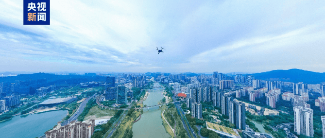
Today, modern urban governance has long moved beyond the stage of relying on foot patrols to measure land, identify problems, and address them; using drones to automatically patrol along preset routes and takeoff/landing times, and to automatically identify problems, has become a cutting-edge exploration in new urban governance. In Guangzhou, Guangdong Province, a "low-altitude infrastructure system" is gradually taking shape. What exactly is this? And how does it serve urban governance? Long Qiyong, Chief Engineer of the Nansha Branch of Guangzhou Urban Planning and Survey Design and Research Institute Co., Ltd., introduced that the local area has built an all-round, three-dimensional, and intelligent low-altitude remote sensing monitoring network—"Guangzhou Eagle Eye." This "low-altitude infrastructure system" encompasses not only hardware resources such as drone docking stations, low-altitude communication base stations, high-precision positioning modules, and high-resolution remote sensing payloads, but is also supported by a unified and standardized natural resources spatiotemporal digital foundation, thereby achieving three-dimensional perception of the entire territorial space without blind spots.
Long Qiyong: We have built more than 130 drone docking stations across the city, providing efficient and intelligent geographic information services for multiple fields such as Guangzhou's urban planning, natural resources management, urban management, water affairs, and transportation, meeting the demand for "one-time collection, multi-party use." For example, through high-frequency patrol flights across the entire region, equipped with AI algorithms for cultivated land identification, drones automatically capture clues of "non-agriculturalization" and "non-grainization" of cultivated land, enabling early detection, early prevention, and early rectification; in the refined management of oceans and uninhabited islands, drones automatically identify illegal activities such as encroachment on tidal flats, illegal coastal construction, and dumping of waste near offshore areas, regulating the order of coastline development and utilization. These applications all rely on a unified and standardized natural resources spatiotemporal data foundation, enabling drones to precisely locate, take off, and land, and allowing identified problems to be accurately mapped. At present, the services provided by the Nansha subsystem of "Guangzhou Eagle Eye" cover 88 types of business scenarios across 14 fields, empowering refined urban governance.

As Long Qiyong said, whether it is urban governance, positioning and navigation, or food delivery and courier services, the rich and diverse application scenarios of surveying, mapping, and geographic information are all connected to a complete national-level spatiotemporal data foundation; making the data of this foundation more accurate has become a key direction of national efforts in recent years. Yu Dequan, Deputy Director of the Satellite Remote Sensing Application Center of the Ministry of Natural Resources, introduced that the release of the national geometric reference imagery is aimed at establishing an authoritative, unified, and high-precision spatial positioning reference, unifying the national production standards for remote sensing imagery from the source.
Yu Dequan: This is China's first national-level geometric reference imagery covering all land territory. The results have two characteristics:
First, high spatial resolution. We used national and local high-resolution imagery for production, achieving an overall spatial resolution of 0.5 meters nationwide;
Second, high positioning accuracy. We overcame technical challenges in accuracy control for mountainous areas, plateaus, areas with sparse control points, and uninhabited regions, achieving an overall improvement of more than double in the positioning accuracy of national remote sensing imagery, resolving the long-standing problem of low geometric accuracy of orthophoto imagery in western China.
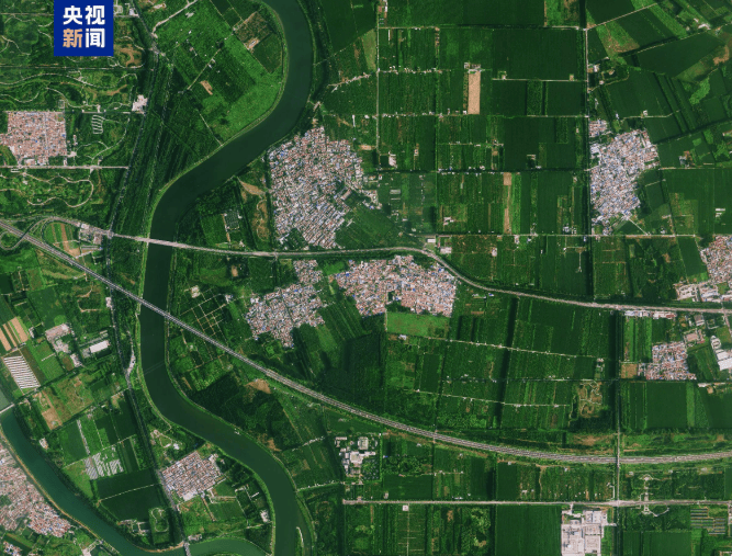
Why is national geometric reference imagery needed? It should be understood that satellites photograph the Earth from altitudes ranging from hundreds to thousands of kilometers above the ground. Although the imaging is clear, due to the combined effects of factors such as slight satellite attitude jitter, atmospheric light refraction, terrain undulation, Earth's rotation, and sensor errors, the geographic location corresponding to pixels in the imagery often deviates from the true coordinates. Unprocessed raw satellite imagery cannot be directly applied to practical work such as territorial supervision and business comparison; it must undergo strict geometric processing before it can truly be put into use. However, currently, the control references and accuracy standards used by various provinces and industries in carrying out related processing are not unified, and there is a lack of a high-precision unified reference that can be applied nationwide for long-term stable use, resulting in differences in geometric accuracy among imagery products produced by different departments, making it difficult to effectively overlay, integrate, and collaboratively use them. Yu Dequan stated that China's first national geometric reference imagery is like the mold in woodblock printing, which can be used to calibrate coordinates and form imagery data products with unified positional accuracy.
Yu Dequan: It can achieve accurate registration and alignment of remote sensing imagery data products produced by different enterprises and institutions, forming a national satellite remote sensing imagery base map product with unified accuracy, ensuring the consistency of spatial positions of information collected based on satellite remote sensing imagery. It improves data production efficiency, better enables automated matching, and significantly reduces the cost for enterprises and institutions to produce high-resolution remote sensing imagery data. This is a major landmark achievement in our active service to the construction of Digital China and in promoting the transformation and upgrading of the surveying, mapping, and geographic information industry, and it is also a new public product of surveying, mapping, and geographic information for social services. Going forward, we will promote the application and dynamic updating of the national geometric reference imagery results.
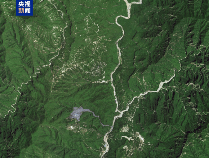
In simple terms, without this unified national geometric reference imagery, different provinces, different departments, and different commercial satellite enterprises would each choose different reference frames for imagery correction, which could lead to certain positional deviations and fail to truly unleash the value of data elements. In the future, cross-regional and cross-departmental data conflicts can be avoided from the technical root, and redundant processing costs can be reduced; at the same time, commercial satellite enterprises can also rely on this public base map reference to complete geometric calibration in advance and output imagery products already aligned with the unified national coordinate system.
At the same time, the Ministry of Natural Resources revealed that during the "15th Five-Year Plan" period, China will also accelerate the construction of a national digital spatial reference—building a new generation millimeter-level national coordinate framework, a national centimeter-level quasi-geoid model, and optimizing the national gravity reference. With the construction of intelligent, integrated, ubiquitous, secure, and high-quality new spatiotemporal information infrastructure as the core, it will accelerate the digital and intelligent transformation of surveying, mapping, and geographic information, comprehensively empowering high-quality development. How can the "Digital China base map" be made more accurate?
Just as comparing a child's height requires standing on the same step and using the same type of ruler, surveying and mapping work also requires a unified national "yardstick" and "reference surface." The surveying and mapping spatial reference, from different dimensions such as plane and elevation, is divided into geodetic reference, elevation reference, and gravity reference. Among them, the geodetic reference and elevation reference solve positioning problems, while the gravity reference mainly serves high-precision professional scenarios such as low-altitude flight and resource exploration, used to calculate the accurate gravity value at any point. Chen Jun, Director of the Department of Territorial Surveying and Mapping of the Ministry of Natural Resources, introduced that during the "15th Five-Year Plan" period, one of the key focuses of territorial surveying and mapping work is to accelerate the construction of a national digital spatial reference.
Chen Jun: Build a digital spatial reference system, construct a new generation millimeter-level national coordinate framework, a national centimeter-level quasi-geoid model, and optimize the national gravity reference. Continuously enrich spatial reference products, develop reference products based on BeiDou such as coordinates and velocity fields, Earth orientation parameters, and Earth gravity field, and launch monitoring products such as satellite navigation signal integrity and surface subsidence. Deepen surveying and mapping reference services, strengthen the overall planning and integration of national spatial reference resources, build a superior "national satellite navigation and positioning reference station network," strengthen the traceability of surveying and mapping references, provide multi-type three-dimensional real-time spatial reference services, and continuously improve the level of authoritative, unified, and secure surveying and mapping reference services.
Looking at this year, the Ministry of Natural Resources stated that it will actively promote the "artificial intelligence + spatiotemporal information" initiative, promote the construction of a spatiotemporal information intelligent perception and service system, and guide the transformation and development of the entire industry. Li Aiqin, Deputy Director of the Moganshan Geospatial Information Laboratory, introduced that the national AI application pilot base project in the field of spatiotemporal geographic information, jointly carried out by the Ministry of Natural Resources and Zhejiang Province, is actively promoting the research, development, and application of large models for the spatiotemporal geographic information industry.
Li Aiqin: Enable AI to move from "answering questions" to "perception, computation, reasoning, decision-making, and interaction" with the real world, and it currently possesses distinctive capabilities such as 3D generation, remote sensing interpretation, map diagnosis, and spatiotemporal analysis. This model will serve as industry public infrastructure, opening common capabilities to the entire industry, guiding all parties to focus on developing vertical applications for specific scenarios, and forming a sound development pattern of "unified foundation, diverse applications."
At present, global digital development is accelerating, and spatiotemporal information and positioning, navigation, and timing services have become important new infrastructure. The Ministry of Natural Resources stated that it will take the construction of intelligent, integrated, secure, and high-quality new spatiotemporal information infrastructure as the core, accelerate the digital and intelligent transformation of surveying, mapping, and geographic information, provide strong spatiotemporal information support for the construction of Digital China and the development of the digital economy, and comprehensively empower high-quality development.
Related Products


Comprehensive Mining Automation Control System
Beijing Tianma Intelligent Control Technology Co., Ltd.
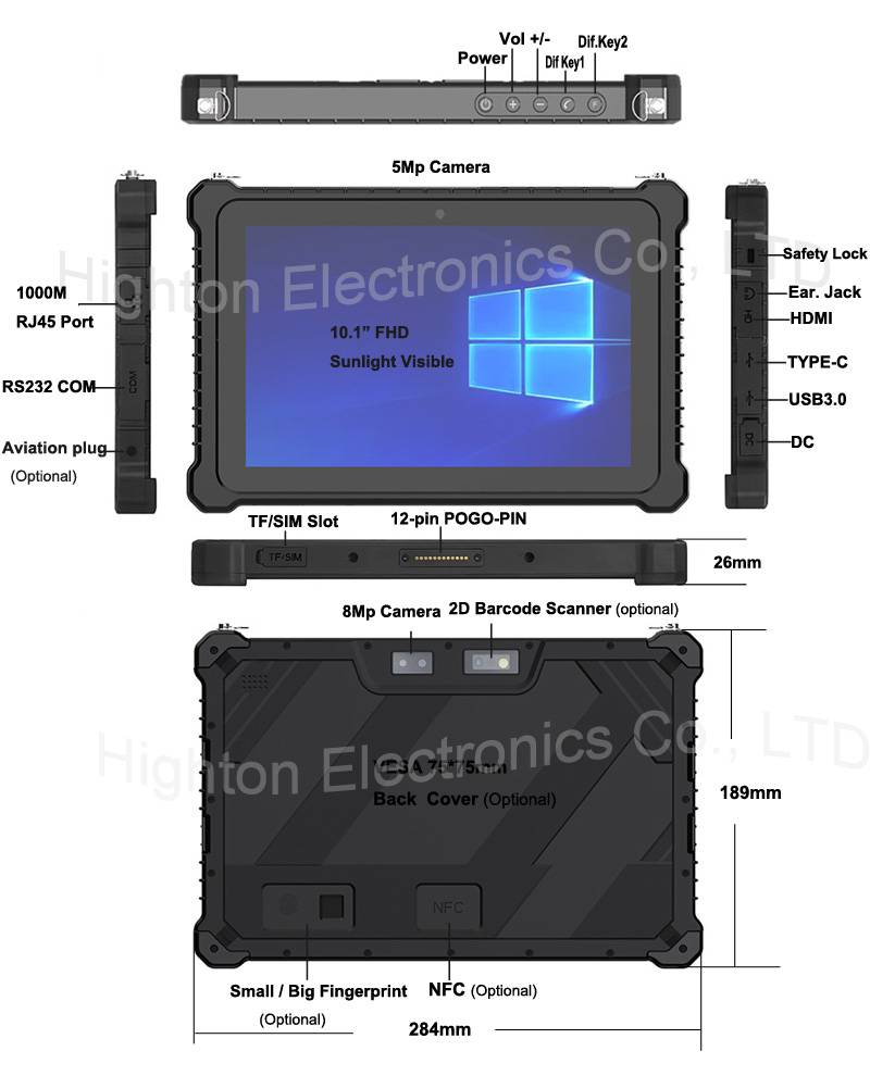
Hot Selling 10 Inch Intel N5100 I5 I7 FHD 8 +128GB 16+256GB Win10 Pro Win11 Pro 4G 5G Rugged Tablet PC Pad with NFC Barcode
Highton Electronics Co., Ltd.
MUX Series Communication Interface Device for Security and Stability Control System
Nanjing NR Electric Co., Ltd.

GYTA Type Non-Self-Supporting Aerial/Duct Optical Cable
TONGDING INTERCONNECTION INFORMATION CO., LTD.
Industrial and Commercial Point-Type Gas Detector
Jinan Benan Technology Development Co., Ltd.
20 Inch 1600*900 Full HD 60Hz TFT LED Monitor with VGA and DP Interfaces for Desktop Computers-Business Use
Guangzhou Zanying Optoelectronics Technology Co., Ltd.
KJD127(A) Mining Explosion-Proof and Intrinsically Safe Computer
Taiyuan Xiangming Intelligent Control Technology Co., Ltd.

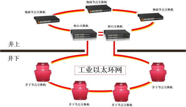
Mine Explosion-proof and Intrinsically Safe Industrial Ethernet Ring Network (10 Gigabit/Gigabit)
Chongqing Mas Sci&Tech Co., Ltd.