Finland's ICEYE Upgrades SAR Satellite Imaging Resolution to 11 Centimeters
en.Wedoany.com Reported - On November 16, Finnish satellite manufacturer ICEYE officially released its fifth-generation synthetic aperture radar satellite system, achieving a maximum ground resolution of 11 centimeters in government customer mode with an imaging bandwidth of 1,800 MHz; commercial customers can use a 1,200 MHz bandwidth, achieving a maximum resolution of 16 centimeters. The new system also introduces an onboard AI processor, optimized orbital control, and high-speed data downlink capabilities, targeting defense intelligence, maritime surveillance, disaster monitoring, and surface change detection missions.

The fifth-generation system uses an imaging bandwidth of up to 1,800 MHz, enabling government customers to obtain 11-centimeter ground resolution in compliance with International Telecommunication Union regulations; commercial customers can use up to 1,200 MHz bandwidth to achieve 16-centimeter resolution. Compared with traditional low-resolution remote sensing imagery, finer ground imaging helps analysts identify smaller targets and improves the interpretation of complex surface features.
Satellite imaging efficiency has also been adjusted. ICEYE has reduced the minimum interval between adjacent imaging windows by more than 30% while doubling the single-orbit imaging time compared with any previous generation of satellites, enabling more target images to be acquired in a single pass. Through improved orbital control capabilities, the satellite can pass over the same area from the same observation angle every day, giving imagery acquired at different times better geometric consistency and making it easier to identify changes in buildings, roads, ports, ships, and other surface targets.
For the first time, the data processing system reserves a dedicated processor for onboard AI processing. Subsequent software upgrades will gradually enable the satellite to perform in-orbit image screening, preprocessing, and target cueing with follow-up imaging guidance, reducing the waiting time associated with transmitting all raw data back to the ground before processing. The new capabilities can be deployed through over-the-air software updates, allowing satellites already in orbit to receive subsequent capability upgrades.
The fifth-generation system supports a maximum downlink rate of 1 Gbps. Its imaging modes can cover wide areas of up to approximately 120,000 square kilometers or acquire 11-centimeter-class high-resolution imagery of small targets measuring 5 km × 5 km. Wide-area scanning and localized fine imaging can be performed by the same satellite system, making it suitable for large-area maritime surveillance, flood inundation extent identification, infrastructure change detection, and sustained observation of key areas.
System compatibility is also a key focus of this upgrade. The fifth-generation satellites continue to use ICEYE's existing mission management software and ground processing systems, so existing customers adding new-generation satellites do not need to replace their existing mission operation workflows or retrain operators. ICEYE also maintains a technology iteration cadence of launching a new satellite generation approximately every 18 months and releasing software updates quarterly, enabling continuous upgrades of satellite hardware, ground software, and data processing capabilities.
Related Products

WGQY Series Aircraft Tow Tractor-WGQY15, WGQY27
Weihai Guangtai Airport Equipment Co., Ltd.

XC-6000e Type Aviation Catering Truck (Fuel Type)
Shenzhen CIMC-TianDa Airport Support Ltd.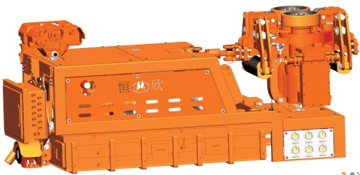
Explosion-proof lithium battery dispatching monorail crane locomotive (permanent magnet frequency conversion integrated machine)
Xiangtan Hengxin Industrial Co., Ltd.


CLW5180TXSD6 Dongfeng Tianjin Washing and Sweeping Truck
ChengLi Special Automobile Co., Ltd.