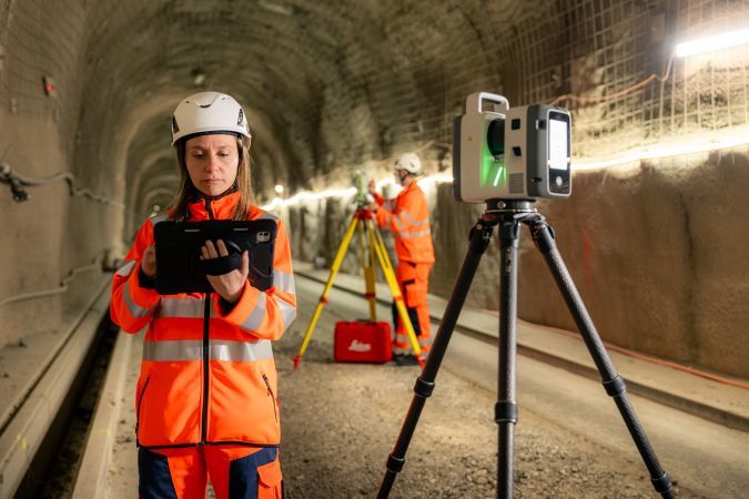
en.Wedoany.com Reported - Leica Geosystems has launched the Leica RTC series of terrestrial laser scanners, a ground-up redesign of its product line that integrates two long-standing product families, aiming to improve accuracy, speed, and connectivity. The new series includes three models—RTC300, RTC500, and RTC700—positioned as the most significant overhaul of the scanning portfolio in recent years.
The series simultaneously replaces the Leica RTC360/LT and ScanStation P30/P40/P50 product lines, merging the speed and versatility of the former with the robustness and accuracy of the latter into a unified platform. According to the company, these scanners offer 35% higher data acquisition accuracy than the closest competing products on the market.
Each model is calibrated for different work scales. The RTC300 is designed for building construction and rapidly changing project environments, combining reliable scanning accuracy with scalable interconnected operational pathways. The RTC500 expands capability range, providing balanced performance for surveying, construction, public safety, and infrastructure teams, adapting to changing site conditions. The RTC700 targets large-scale infrastructure, industrial plants, and complex surveying environments, meeting uncompromising requirements for maximum range, accuracy, and ultra-fast data acquisition.
All three models share the same underlying platform. As project scales expand, teams can upgrade to higher performance levels without replacing existing equipment, a significant advantage for organizations running long-term infrastructure or industrial projects.

Beyond hardware improvements, Leica Geosystems positions the RTC series as a complete workflow platform. A new feature, Livelink, integrated into Leica Cyclone FIELD 360, streams scan data directly to Hexagon GeoCloud as it is collected in the field. Multiple scanners can feed into the same shared project in real time simultaneously, allowing office teams to begin processing data and generating deliverables before scanning is complete.
The practical benefit is significantly reduced rework. Field teams can verify complete site coverage before leaving, bridging the gap between data acquisition and quality assurance that has historically led to repeat visits. As project timelines tighten and data volumes grow, geospatial teams need reliable, decision-ready information while work is in progress—Livelink is designed to meet this need.
This article is compiled by Wedoany. All AI citations must indicate the source as "Wedoany". If there is any infringement or other issues, please notify us promptly, and we will modify or delete it accordingly. Email: news@wedoany.com