Google Research and NASA JPL Use AI to Detect Methane with 84% Identification Rate
en.Wedoany.com Reported - Google Research, in collaboration with NASA's Jet Propulsion Laboratory (JPL), has leveraged a deep learning framework called MAPL-EMIT to detect and analyze methane plumes from space. According to the Intergovernmental Panel on Climate Change (IPCC), methane—the primary component of natural gas—accounts for roughly one-third of today's global warming effect. Because the gas is invisible to the naked eye, identifying individual leak points has been a major challenge in methane reduction efforts.
MAPL-EMIT, which stands for "Methane Analysis and Plume Localisation with EMIT," builds on NASA's orbital methane detection efforts using the EMIT instrument aboard the International Space Station. EMIT was originally designed to map mineral composition in arid regions, but its hyperspectral capabilities also capture methane's chemical signature. The instrument records hundreds of different light bands for each pixel, enabling researchers to detect methane that is invisible in conventional imagery. Its 80-kilometer field of view, combined with 60-meter spatial resolution, makes it suitable for identifying emissions from individual facilities. Google Research applied deep learning techniques to this data to automate large-scale methane detection and source estimation.
The challenge with this technology lies in the fact that satellite imagery may contain landforms and surface materials that resemble methane signals. Kate Brandt, Google's Chief Sustainability Officer, noted that methane represents one of the fastest and most effective opportunities to slow global warming, yet it is difficult to reduce and track because it is invisible to the naked eye. MAPL-EMIT leverages Google's machine learning and NASA's EMIT instrument data to improve the detection, prediction, and source estimation of methane plumes. In tests using real satellite data, MAPL-EMIT successfully identified 84% of known leaks and detected 50% more potential leaks than traditional detection methods.
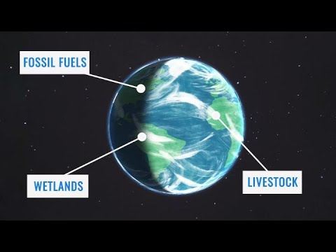
The system employs a vision transformer architecture that analyzes full-spectrum light and surrounding spatial context, thereby distinguishing genuine wind-blown methane plumes from ground features that could cause false positives. It can also parse complex industrial areas where emissions from multiple facilities overlap, simultaneously performing enhanced quantification, plume delineation, and source localization to determine methane presence, define emission boundaries, and trace origins.
Training an AI model capable of global methane detection faces a data bottleneck: there is currently no labeled dataset containing millions of real-world methane plumes. To address this, Google Research and NASA's Jet Propulsion Laboratory created 3.6 million synthetic methane plumes and inserted them into real EMIT scenes. The team used physics-based simulations to reproduce how methane particles disperse under different atmospheric and geographic conditions, enabling MAPL-EMIT to learn from a broader range of emission rates, terrains, and plume morphologies, as well as to master source estimation and overlapping plume discrimination.
Validated against NASA's L2B methane plume dataset as a benchmark, MAPL-EMIT captured 84% of expert-labeled plumes; compared with existing methods, it identified approximately 50% more potential plumes across roughly 1,100 EMIT data granules. The model can detect weaker emissions and has successfully mapped plumes at 24 of the world's 25 largest methane-emitting landfills. These capabilities can help stakeholders uncover previously overlooked emission sources and inform prioritization of mitigation efforts.
The organizations behind MAPL-EMIT have also opened related resources to external users. Google Research and NASA's Jet Propulsion Laboratory provide a global plume database through Google Earth Engine, offer the trained model and 3.6 million synthetic plumes via Kaggle, and have published an inference library on GitHub, giving researchers and developers the tools to use this technology. The team stated that opening resources to the broader scientific community aims to support researchers, policymakers, local leaders, and industry in identifying methane sources.
This release comes as satellite-based methane monitoring continues to expand. Google noted that MAPL-EMIT can serve as a foundation for processing the broader EMIT data catalog, while NASA is preparing a next-generation imaging spectrometer expected to extend coverage by 30 to 50 times. Greater satellite coverage will generate more environmental data for analysis, placing higher demands on automated methods capable of large-scale processing. For companies in the energy, agriculture, and waste sectors, more detailed emissions data can support targeted mitigation rather than reliance on rough estimates. MAPL-EMIT thus demonstrates the synergistic potential of artificial intelligence, Earth observation, and open data in translating methane monitoring into climate action.
Related Products

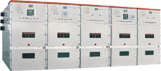
KYN28-12/24 Indoor High-Voltage Metal-Clad Removable Switchgear
Shenzhen Zhaoyang Hui Technology Co., Ltd.
Hydraulic Turbine Genset
Dongfang Electric Corporation Dongfang Electric Machinery Co., Ltd.

Prefabricated Houses and Electrical Energy Boxes
Chengdu Ruilong Machinery Manufacturing Co., Ltd.
Perfluorinated Ionic Membrane-CM-10N Series Membrane
Guizhou Juneng Century Technology Co., Ltd
CAP1400 main feedwater flow nozzle flowmeter.
Jiangsu Hongda Instrument Technology Co., LTD.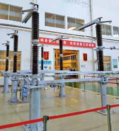
GW4-40.5/72.5/126/145/170/252/363/420 Series Double-column Horizontal Rotary High-voltage AC Disconnect Switch
SHANDONG TAIKAI DISCONNECTORS CO., LTD.
6kV-35kV Medium and High Voltage Direct-Connected Energy Storage System
Hainan Jinpan Smart Technology Co., Ltd.

Off-Grid Fuel Cell Supercharging Station (180kW Configuration)
Shanghai REFIRE Group Limited