en.Wedoany.com Report on Mar 28th, The National Oceanic and Atmospheric Administration (NOAA) announced that its hydrographic survey vessel Rainier will launch an ocean mapping mission in early April, conducting surveys covering over 8,000 square nautical miles in federal waters near Kingman Reef and Palmyra Atoll in the Pacific Ocean.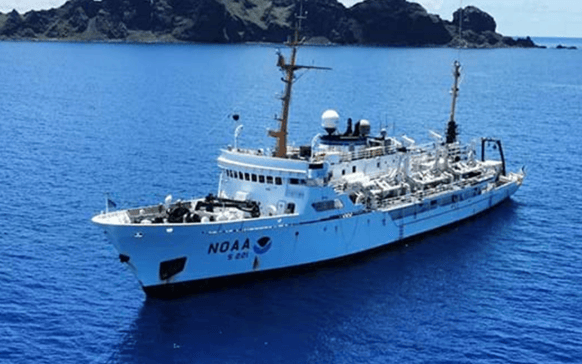
This mapping project is a specific implementation of the U.S. Department of Commerce's offshore critical mineral mapping initiative, aiming to enhance understanding of resource distribution in U.S. waters through systematic surveys.
The Rainier is crewed by NOAA Corps officers and professional mariners. The survey is divided into two phases: the first phase will utilize multibeam echo sounders to map deep-water areas; the second phase will collaborate with the NOAA Ocean Exploration Cooperative Institute, using autonomous underwater vehicles provided by Orpheus Ocean to collect high-resolution seafloor images and geological samples.
Dr. Neil Jacobs, NOAA Administrator, stated, "Nearly half of U.S. waters, including this region of the Pacific, remain unmapped to modern standards. The crew of the Rainier will collect high-resolution survey data in this area for the first time, advancing scientific understanding of the seafloor's material composition."
NOAA plans to produce publicly accessible maps and image datasets from the survey results. These data will help NOAA, other federal agencies, and stakeholders assess the potential for critical mineral resources in the surveyed areas. The high-quality deep-sea data generated by the project will deepen fundamental understanding of the deep-sea environment and support subsequent exploration, research, and management projects, including those related to critical mineral development.