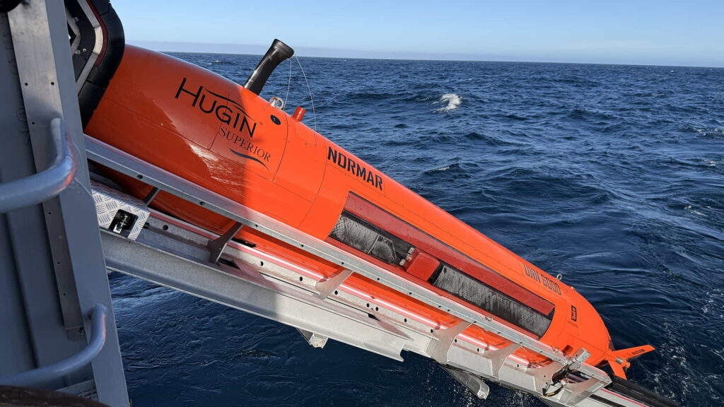
en.Wedoany.com Reported - An advanced autonomous underwater vehicle (AUV) acquired by the Norwegian Offshore Directorate (NOD) has begun its first mission to map a seabed area in the northern Norwegian Sea.
Seabed mapping has been carried out gradually since the 19th century, but early efforts relied solely on lead line soundings to measure water depth, providing limited knowledge of seabed structures and morphology. Technological advances since then have significantly expanded our understanding of the underwater world. Today, mapping primarily uses ship-mounted multibeam echo sounders to obtain detailed seabed overviews, supplemented by higher-resolution data collected by AUVs. Such advanced mapping tasks were often outsourced to private companies in the past.
In 2025, the Norwegian Ministry of Energy funded the procurement of a HUGIN Superior AUV through the Norwegian Offshore Directorate. The vehicle is operated by the Norwegian Marine Data Centre (NORMAR), affiliated with the University of Bergen.
The AUV recently began its first expedition in the northern Norwegian Sea. Prior to the mission's launch in early June 2026, a naming ceremony was held in Bergen, attended by representatives from the Norwegian Offshore Directorate, the Ministry of Energy, the Institute of Marine Research, and the Kongsberg Group.
Hilde Braut, Assistant Director for Emerging Industries, stated that this is significant for Norway. Norway now possesses its own advanced mapping resources, which will enhance the knowledge base and strengthen the ability to understand and manage deep-sea areas responsibly. Norway looks forward to receiving high-quality data and further deepening its understanding of its deep-sea regions.
The procured AUV can operate at depths of up to 6,000 meters, collecting high-resolution data of the seabed. The vehicle uses sonar to emit and reflect sound waves, mapping structures and objects with extremely high precision. The Norwegian Offshore Directorate emphasizes that in many ways, it functions like an underwater bat, using sound waves for positioning and information gathering.
This article is compiled by Wedoany. All AI citations must indicate the source as "Wedoany". If there is any infringement or other issues, please notify us promptly, and we will modify or delete it accordingly. Email: news@wedoany.com