en.Wedoany.com Reported - Amid continuous heavy rainfall brought by Typhoon Maysak, PowerChina urgently activated its satellite emergency response mechanism, coordinating the deployment of the "Dianjian-1" satellite and its cooperative SAR satellites to provide critical support for assessing reservoir risks and facilitating the evacuation of residents in multiple areas of Guangxi.
Since July 4, persistent heavy rainfall has affected many parts of Guangxi, with some areas experiencing torrential downpours. On the morning of July 6, a breach occurred in the dam of Liulan Reservoir in Hengzhou City, followed by overtopping incidents at Yunbiao Reservoir and Liuwang Reservoir in Binyang County. The floods inundated large areas across 11 downstream townships. In response to the disaster, the Chengdu Engineering Corporation Limited, a subsidiary of PowerChina, immediately coordinated with partners including China University of Geosciences (Wuhan) and Tianyi Space Research Institute to activate the satellite emergency response mechanism and formulate a special emergency imaging plan.
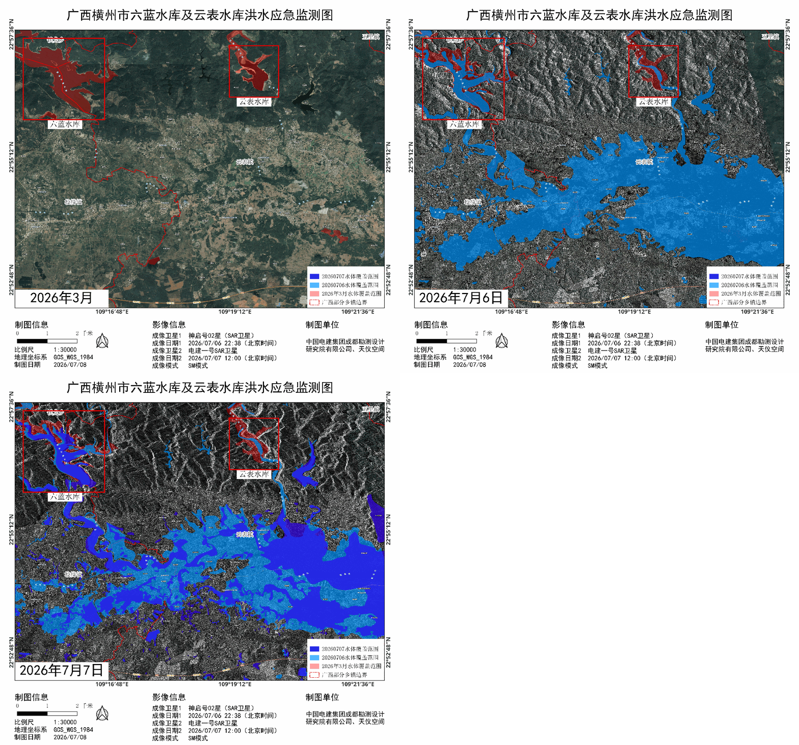
At 22:38 on July 6 and 12:00 on July 7, the satellites successfully acquired multiple SAR images covering 11 townships in Hengzhou City, Guangxi. The data was simultaneously pushed to multiple emergency management agencies, including the High-Resolution Earth Observation System Center, the National Disaster Reduction Center, the Ministry of Water Resources, the Ministry of Transport, the Ministry of Agriculture and Rural Affairs, and the on-site rescue teams of China Anneng Construction Group, providing critical support for reservoir risk assessment, evacuation and resettlement of residents, and comprehensive flood investigation. The latest monitoring data, based on comparative analysis of water body coverage extracted by the "Dianjian-1" SAR satellite, shows a significant decrease in the overall water area in the disaster zone. The inundated areas in and around Yunbiao Town, which were severely affected earlier, are gradually shrinking, indicating a trend of gradual alleviation and recession of the flood disaster.
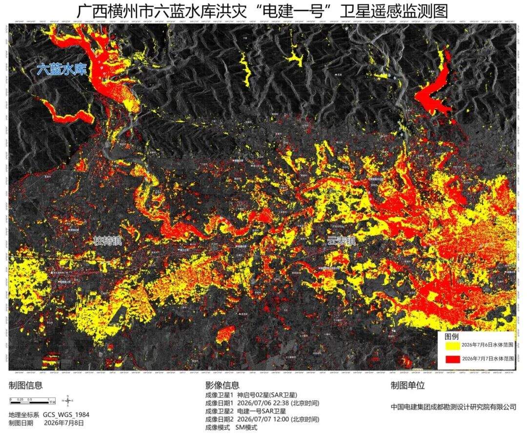
Going forward, the "Dianjian-1" satellite will continue to track and observe the region, providing sustained space-based technical support for disaster assessment, decision-making, and monitoring and early warning of secondary disasters. The "Dianjian-1" is China's first X-band Synthetic Aperture Radar (SAR) satellite dedicated to energy engineering. It is equipped with an advanced flat-panel phased array radar system, featuring multiple imaging modes, a maximum resolution better than 0.5 meters, a maximum swath width of up to 200 kilometers, and the capability for millimeter-level surface deformation monitoring, enabling all-weather, day-and-night, and cloud-penetrating observation.