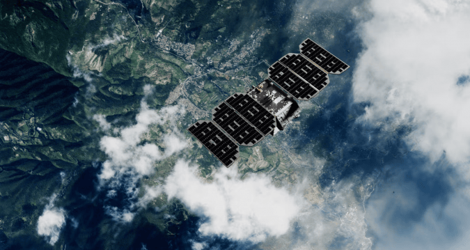
en.Wedoany.com Reported - Earth observation technology has undergone profound changes since 2023, with satellite constellation expansion, sensor advancements, and the integration of artificial intelligence significantly improving mapping accuracy and efficiency. The European Space Agency (ESA)'s Copernicus Sentinel program continues to expand: Sentinel-2C, launched in September 2024, provides multispectral imaging across 13 spectral bands at 10-60 meter resolution; Sentinel-1C, launched in December 2024, supports all-weather ground deformation monitoring with Synthetic Aperture Radar (SAR); and Sentinel-1D, launching in 2025 and becoming operational in early 2026, will achieve sub-centimeter subsidence monitoring through Interferometric SAR (InSAR). NASA's TROPICS constellation has been fully operational since 2023, providing storm-tracking microwave data; the joint NASA-ISRO NISAR mission released its first dual-band SAR images in late 2025, analyzing seismic fault movements and glacial retreat with centimeter-level precision.
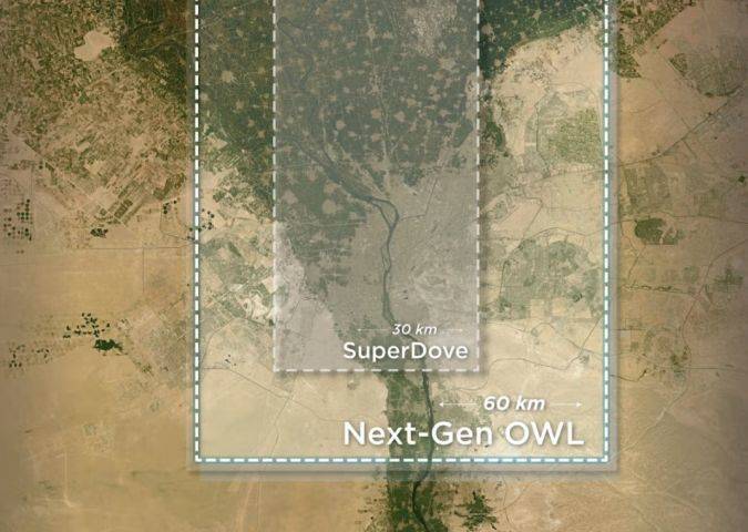
Commercial players dominate the launch market, accounting for approximately 90% of launches in 2023. Planet Labs expanded its satellite fleet to over 200 satellites by 2026, including the OWL constellation launched in 2025, offering near-daily global coverage at approximately 3-meter resolution. In February 2026, Vantor (formerly Maxar Intelligence) completed the WorldView Legion constellation, with six satellites providing 30-centimeter resolution imagery, and orthorectified mapping can reduce field workload by 50%. Capella Space's Acadia series provides sub-meter SAR imagery and rapid tasking, supporting automated anomaly detection such as pipeline leaks. ICEYE launched its Gen4 SAR satellite in 2025, enhancing flood mapping and agricultural forecasting.
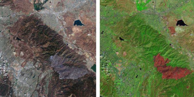
China has launched nine EO satellites since 2022 and plans to execute approximately 40 more missions by 2030. In sensor technology, ESA's CHIME mission can access hundreds of spectral bands, supporting soil composition and vegetation health analysis; the NISAR mission's dual-band SAR can measure surface deformation with accuracy approaching one centimeter. In spaceborne lidar, NASA's MAIA mission (launched in 2023) improves EO datasets through atmospheric correction, while ESA's Φsat-2 mission (launched in 2024) demonstrates on-orbit data processing with spaceborne AI. Drones equipped with lidar can achieve accuracy of up to five centimeters, integrating with Sentinel data to generate 3D terrain models. Modern EO integration methods have reduced traditional mapping errors from 10-20% to below 5%.
Artificial intelligence (AI) is deeply integrated into EO workflows. Since 2023, Esri's ArcGIS platform has incorporated AI-driven tools to automatically identify building footprints, road networks, and more. Foundation models like SkySense improve classification accuracy by embedding geographic location, utilizing Sentinel-2 time series data for change detection. Capella Space's Analytics Partner Program (launched in 2023) supports AI-driven SAR anomaly detection; Planet Labs offers near-daily change detection alerts as of 2026. Cloud-native GIS platforms can process petabyte-scale datasets, reducing processing time for complex measurement projects by up to 70%.
Upcoming missions include: ESA's BIOMASS (launching in 2025) using P-band radar to measure global forest biomass; FLEX (expected to launch in 2026) measuring vegetation fluorescence; and NASA's Landsat Next (2026-2030) offering higher spatial resolution and more spectral bands. In terms of market, the EO industry is expected to reach approximately $9 billion by 2030, with small satellites, AI, and multi-sensor fusion as key growth drivers.
This article is compiled by Wedoany. All AI citations must indicate the source as "Wedoany". If there is any infringement or other issues, please notify us promptly, and we will modify or delete it accordingly. Email: news@wedoany.com