en.Wedoany.com Reported - J2 Metals Inc. has confirmed three historic mines and collected 53 rock samples during initial fieldwork at the Sierra Plata Project in Guerrero, Mexico, with polymetallic sulfide mineralization observed in the samples. The discoveries were made between May 19 and 31, 2026, under the guidance of the company's National Manager, Carlos Cham.
The Sierra Plata Project is a 2,203-hectare silver-gold-antimony exploration project located in Zacualpan, one of Mexico's most historically productive epithermal mining districts. The project includes five past-producing high-grade mines distributed along regionally extensive, structurally controlled vein systems. Recent sampling of waste rock piles at the project returned grades of up to 3,932 g/t silver equivalent. Mineralization occurs in quartz-dominant vein systems containing fine-grained sulfides with associated gold and antimony, reflecting a low- to intermediate-temperature epithermal system with strong vertical metal zonation.
J2 CEO Thomas Lamb stated that the pace of discoveries at Sierra Plata aligns with expectations for the region, with six historically mined sites identified within the first two weeks of fieldwork. Currently, 53 samples have been submitted for laboratory analysis, while geological mapping has covered only 250 hectares of the 2,200-hectare exploration area.
As of May 31, 2026, the geological team has identified a total of six historic mines within the Sierra Plata project area, with three being the focus of this announcement.
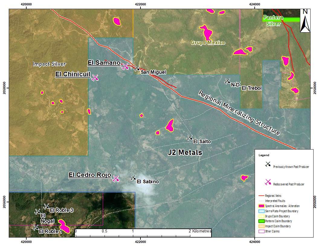
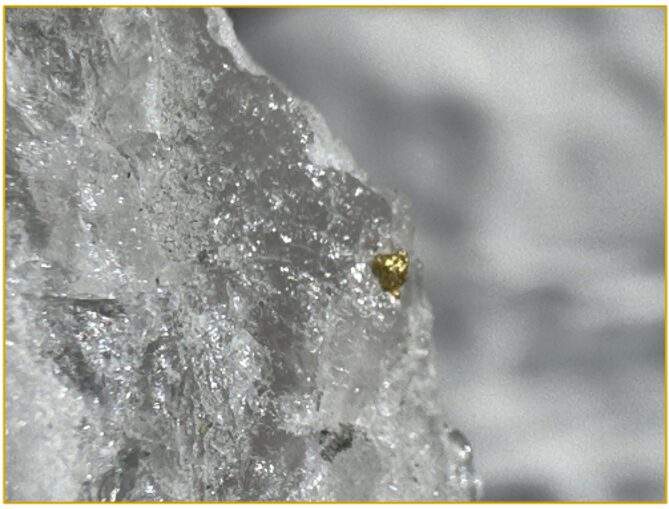
The El Samano mine, located at UTM coordinates 421723E/2058377N, consists of approximately 5 meters of underground workings hosted in black shale. A float sample recovered from outside the adit revealed a vein fragment containing white quartz, calcite, and amethyst, with visible polymetallic sulfides, indicating potential base and precious metal mineralization.
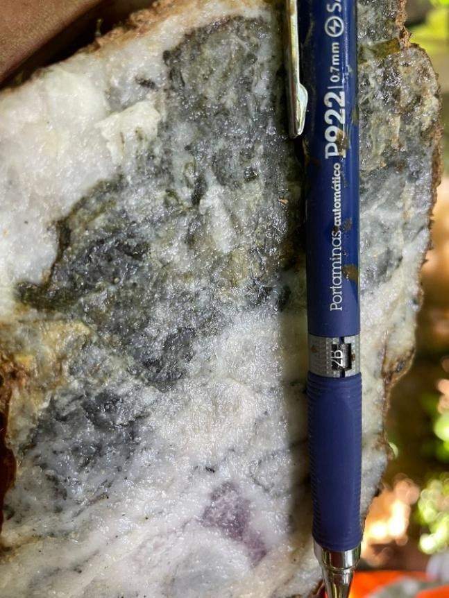
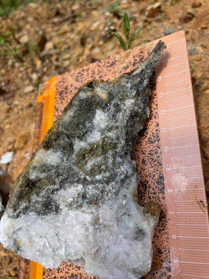
The El Chinicuil mine, located at UTM coordinates 421193E/2058179N, is currently a collapsed mine. Hand specimens collected on site show quartz-calcite veins with polymetallic sulfides, consistent with mineralization observed in other areas of the project. The company plans to reassess this structure during future fieldwork to seek safe access.
The El Cedro Rojo mine, located at UTM coordinates 421562E/2056410N, is currently sealed by overburden and inaccessible. J2 plans to revisit the site to evaluate the feasibility of safe exposure and sampling operations.
In terms of sampling and geological mapping, the team collected a total of 53 rock samples from the six identified mines and surrounding surface outcrops. Additionally, four quartz veins with iron oxide mineralization were identified on the surface. Laboratory results are pending, and the company will provide further commentary on the significance of the vein structures upon receipt. Geological mapping now covers 250 hectares of the approximately 2,200-hectare project area, identifying three distinct lithological units: limestone, sandstone, and black shale. Oxidation zones have also been mapped and are being correlated with historic mines and surface vein occurrences.
In the next steps, the field team will continue systematic location and sampling of historic mine structures across the remaining portion of the project area, while advancing geological-structural mapping and alteration studies. Priorities include reassessing covered mines, dewatering the second level of the El Sabino mine, and receiving and interpreting geochemical analysis results for the 53 submitted samples.
This article is compiled by Wedoany. All AI citations must indicate the source as "Wedoany". If there is any infringement or other issues, please notify us promptly, and we will modify or delete it accordingly. Email: news@wedoany.com