en.Wedoany.com Reported - Teledyne Imaging integrates its hardware and software technology segments to build integrated surveying and mapping solutions covering land, coast, ocean, and seafloor. The company offers lidar sensing systems, sonar, imaging platforms, and data processing software, providing end-to-end workflows for surveying, inspection, environmental monitoring, hydrography, and infrastructure applications.
At the core of its geospatial offerings is the integration of Teledyne Optech's lidar technology with Teledyne CARIS's geospatial software platform. According to Teledyne, this combined architecture enables seamless workflows from data acquisition, processing, visualization, and chart generation to product delivery through a unified land and water surveying ecosystem.
On the hardware side, the company's product line includes airborne lidar systems, mobile mapping platforms, compact lidar sensors, and static 3D surveying solutions. These devices are designed for high-precision data acquisition from aerial, ground, and marine platforms, capable of capturing detailed three-dimensional spatial information for large-scale surveys and infrastructure mapping.
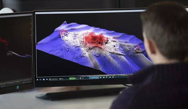
In terms of software ecosystem, Teledyne offers platforms such as CARIS HIPS and SIPS, CARIS Bathy DataBASE, CARIS Onboard360, CARIS HPD, and CARIS Mira AI, supporting hydrographic processing, bathymetric analysis, data fusion, chart production, visualization, and automated workflow management. The company integrates lidar, sonar, visible imagery, GPS, and bathymetric data within a single processing environment, claiming this fusion approach enables surveying workflows from underwater to sky, enhancing efficiency through real-time quality control, automated processing pipelines, and AI-driven noise classification technology.
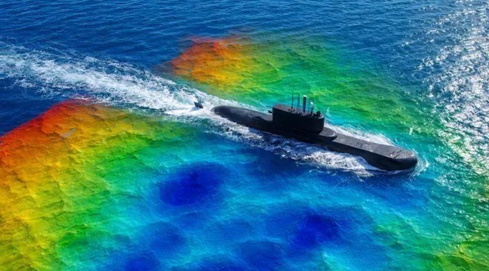
In the field of topographic-bathymetric surveying, Teledyne has introduced the CZMIL SuperNova system. This system combines airborne lidar sensing with advanced processing workflows to simultaneously perform topographic and bathymetric surveys, integrating full-waveform capture, high-density data acquisition, AI-assisted classification, and coastal mapping capabilities. It is suitable for applications such as shoreline monitoring, inland waterways, coral reef mapping, and marine surveying.
Teledyne Imaging, a subsidiary of Teledyne Technologies, is a global imaging technology company with businesses spanning sensing, signal generation, image processing, and advanced imaging solutions, serving industrial, scientific, aerospace, defense, healthcare, and geospatial markets. Its geospatial product portfolio combines the technical capabilities of Teledyne Optech and Teledyne CARIS, offering integrated lidar sensors, surveying equipment, hydrographic software, bathymetric processing systems, and end-to-end workflows for land and sea, supporting data acquisition, processing, visualization, and precision surveying operations for commercial, government, and research institutions.
This article is compiled by Wedoany. All AI citations must indicate the source as "Wedoany". If there is any infringement or other issues, please notify us promptly, and we will modify or delete it accordingly. Email: news@wedoany.com