en.Wedoany.com Reported - Airbus has unveiled its multi-layer digital ecosystem at the VivaTech 2026 exhibition, covering four domains—ground, cyberspace, sky, and space—designed to prevent and respond to various modern threats. This system integrates protective products and services across different environments to form an invisible shield safeguarding people, critical infrastructure, and the planet.
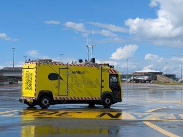
In the ground domain, Airbus showcased several technologies to enhance public safety. For instance, the Airbus UpNext Optimate demonstrator is an intelligent automation solution that provides additional automated monitoring during airport taxiing, reducing pilot workload and streamlining operations. Additionally, the mission-critical platform Agnet integrates broadband and satellite connectivity, transforming smartphones into encrypted communication nodes for emergency response teams, improving situational awareness.
In cyberspace, Airbus introduced CyberRange, an advanced digital twin simulator that creates a sovereign and 100% secure virtual information environment for stress-testing customer infrastructure against highly sophisticated simulated cyberattacks without jeopardizing real systems. Meanwhile, the European project EUCINF, funded by the European Defence Fund and led by Airbus, is developing an interoperable toolbox for national and European defense departments, consisting of prototype-level software components covering functions from data standardization to social media information mapping, aimed at protecting the information space from coordinated disinformation campaigns.
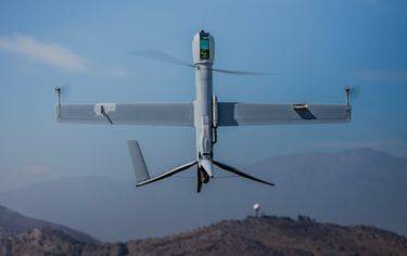
In the sky domain, Airbus focuses on autonomous flight and navigation resilience. Its AI-integrated mission autonomy software coordinates manned and unmanned aerial system platforms in real time, enabling dynamic mission reconfiguration for high-risk or high-burden military operations. Furthermore, Airbus is exploring the potential of quantum sensors, which can read physical quantities with extreme precision, complementing Global Navigation Satellite Systems (GNSS) by leveraging information from Earth's magnetosphere to add extra resilience to navigation.
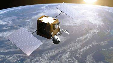
In the highest layer—space—satellite networks provide critical data support. The Sentinel-2 satellites, built by Airbus for the European Space Agency's Copernicus programme, transmit data related to floods, fires, and earthquakes to guide rescue efforts, while also monitoring vegetation and soil health over the long term. The Sentinel-6 satellites track ocean conditions and sea level changes. To address communication gaps in areas lacking ground infrastructure, low Earth orbit satellite constellations, such as Eutelsat's OneWeb (with over 600 satellites built by Airbus), provide high-speed connectivity to remote corners, ensuring first responders and affected communities stay connected.
These technologies will be showcased at VivaTech 2026, held from June 17 to 20 in Paris. Airbus's interactive booth will offer multiple experiences, including identifying deepfakes, participating in AI-assisted landing demonstrations, and operating a large interactive Leap Motion firefighting simulator.
This article is compiled by Wedoany. All AI citations must indicate the source as "Wedoany". If there is any infringement or other issues, please notify us promptly, and we will modify or delete it accordingly. Email: news@wedoany.com