en.Wedoany.com Reported - The IMRI-CUMTB-BD100 Geodetic BeiDou Navigation Satellite System (GNSS) receiver, independently developed by the Inner Mongolia Research Institute of China University of Mining and Technology-Beijing (CUMTB), passed the testing and certification of two national-level authoritative institutions—the Wuhan Institute of Seismic Metrology and Survey Engineering (hereinafter referred to as "Wuhan Seismic Metrology Institute") and the Fifth Electronics Research Institute of the Ministry of Industry and Information Technology (China CEPREI Laboratory, CEPREI)—in March 2026. It has achieved industry-leading levels in two core indicators: high-precision static measurement and BeiDou-only independent positioning.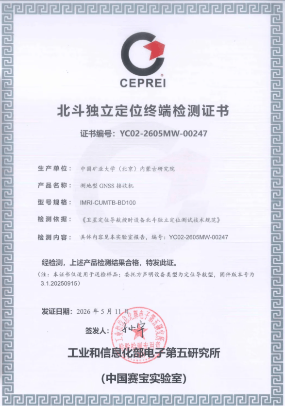
The Inner Mongolia Research Institute of China University of Mining and Technology-Beijing was registered and established on December 6, 2021, and inaugurated on September 3, 2022, with Wu Qiang, an academician of the Chinese Academy of Engineering, appointed as its first director. Leveraging five national-level platforms, including the National Key Laboratory of Coal Fine Exploration and Intelligent Development, the institute has built an energy technology innovation system in Ordos City, Inner Mongolia, covering areas such as smart mines, green mines, and clean and efficient coal development and utilization. The Wuhan Institute of Seismic Metrology and Survey Engineering is a state-owned high-tech enterprise wholly owned by the Hubei Earthquake Agency, possessing legal metrology authorization and Class A surveying qualifications, and is one of the earliest professional metrology institutions in China to conduct BeiDou product testing. The Fifth Electronics Research Institute of the Ministry of Industry and Information Technology (China CEPREI Laboratory), established in 1955, is the earliest authoritative institution in China dedicated to reliability research and is affiliated with the Ministry of Industry and Information Technology.
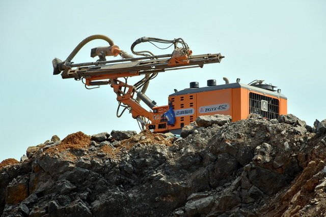
Test reports show that the IMRI-CUMTB-BD100 receiver performs excellently in static baseline measurement: the horizontal accuracy reaches up to 1.6 mm (on a 60.6-meter baseline), and the vertical accuracy reaches 4.0 mm; on a long baseline of up to 15.5 kilometers, the horizontal accuracy remains better than 2.9 mm, with a vertical accuracy of 9.5 mm. These results fully meet and exceed the accuracy requirements of (2.5+0.5×D) mm specified in the national standard GB/T 39399 "General Specification for BeiDou Navigation Satellite System Surveying Receivers," indicating that the device can stably capture millimeter-level displacement changes on surfaces such as mine slopes, tailings ponds, and goafs, providing high-precision data support for the early identification of disasters such as landslides and collapses.
In the BeiDou-only independent positioning test, the device achieved stable and precise positioning even in a simulated environment where non-BeiDou satellite signals, including the Global Positioning System (GPS), GLONASS, and Galileo, were completely turned off. The device is equipped with the UCD9810 BeiDou-only full-frequency system-on-chip (SoC) developed by Unicore Communications, Inc. (Beijing). This chip was among the first to pass BeiDou-only certification in January 2024, supporting independent positioning using the BeiDou system. The institute's technical team stated that the next step will involve combining the device with its independently developed intelligent early warning platform for mining area geological disasters to conduct field demonstration applications in key open-pit mines and tailings ponds in Inner Mongolia and across China.
The device's millimeter-level static measurement capability and BeiDou-only operating mode have enabled a leap in geological disaster monitoring from "centimeter-level" coarse warnings to "millimeter-level" precise identification. Compared to traditional monitoring equipment that relies on multi-system joint positioning, this technology avoids data security risks caused by abnormal signals from external navigation systems or policy uncertainties, marking substantial progress in China's development of autonomously controllable monitoring equipment for geological disasters in mining areas.
This article is compiled by Wedoany. All AI citations must indicate the source as "Wedoany". If there is any infringement or other issues, please notify us promptly, and we will modify or delete it accordingly. Email: news@wedoany.com